
Blizzard Warning in effect from Sat Jan 29, 12:00am EST until Sun Jan 30, 12:00am EST.
RI has declared a state of emergency and imposed a travel ban Sat until 11:59pm for all vehicles. RIPTA has suspended all service Sat.
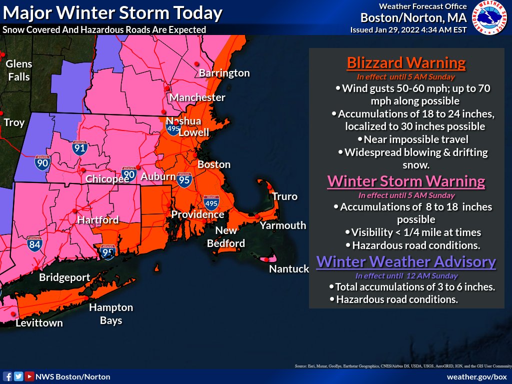
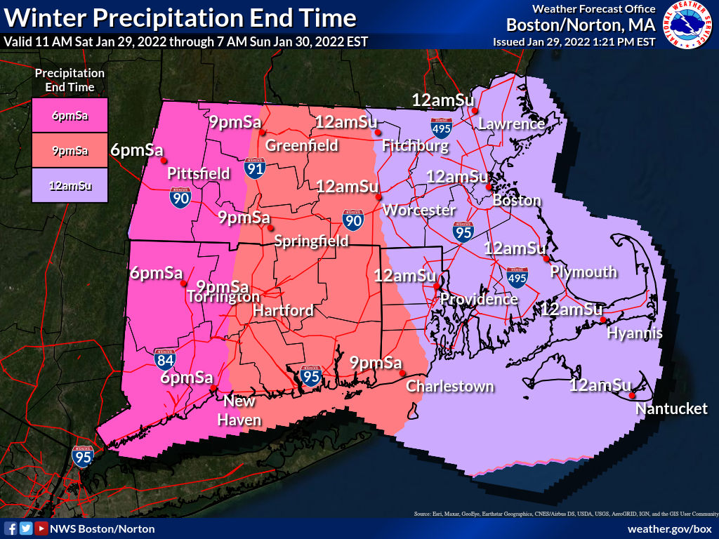
A classic “nor’easter” winter storm is bringing blizzard conditions and an estimated 12–24 inches of snow to southeastern New England between Fri 9pm and Sat 8pm. Snowfall rates of 2–4 inches per hour are possible, resulting in near-zero visibility and extremely difficult travel.
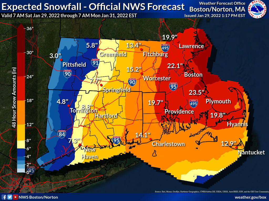
Median accumulation at Providence is 20 inches, with probabilities near 100% for at least 2 in, 99% for 4 in, 98% for 6 in, 95% for 8 in, 84% for 12 in, and 45% for 18 in.
Forecast models are in agreement on the strength of the storm, with the potential for sufficiently rapid development to be classed as “bombogenesis,” defined as a drop in central pressure of at least 24mb over 24 hours.
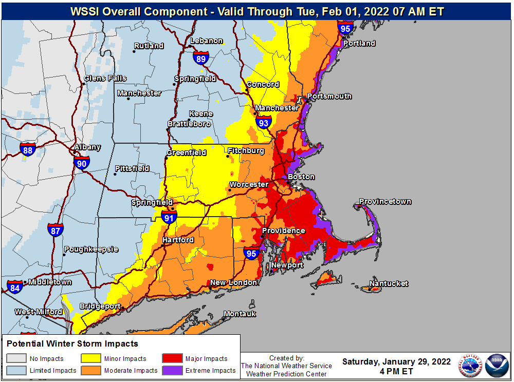
The most probable scenario according to forecast models is that the offshore storm will produce heaviest snow over Cape Cod and the Islands with decreasing amounts to the west, placing Providence at the western edge of the “extreme impact” region, and Hartford and Worcester in the “major impact” region. Deviation of the storm track either to the west or the east could significantly increase or decrease severity, respectively, at Providence.
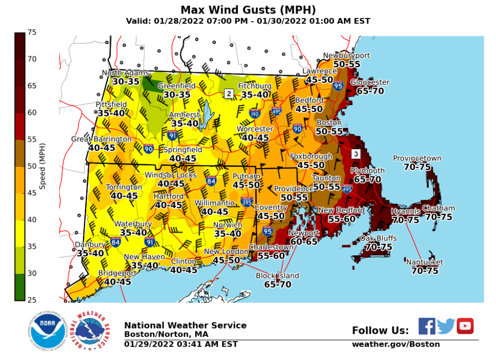
High winds are expected, their strength depending upon how closely the storm tracks, but gusts to 60MPH are possible close to the storm.
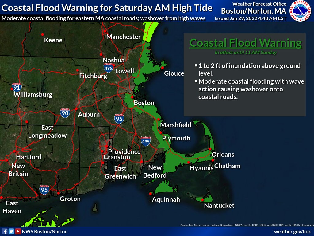
Astronomical high tides are a certainty for Saturday, causing a risk of coastal flooding.
More Posts by The Author:
Heavy Rain, High Winds, Flooding Wed–Thu: Advisory for wind, watches for inland and coastal flooding posted
River Flood Warnings in RI, MA, CT: Wed through Fri, streets may be impassable at times
Snow possible but unlikely Sat mid-day: Little accumulation likely
Snow Thu Night: One inch expected
Significant Snow Storm Tue 5am – 3pm: Likely 6in but remote possibility up to 18in