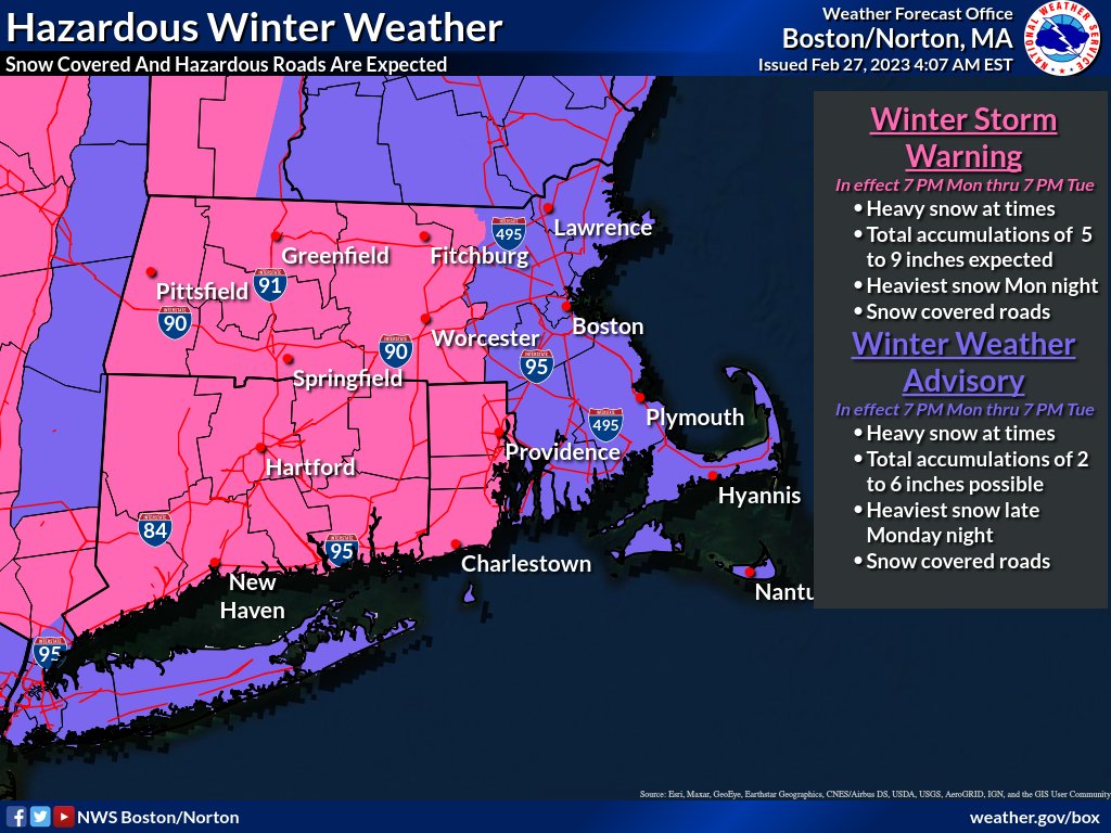
A Winter Storm Warning has been issued for Mon 7pm – Tue 7pm.
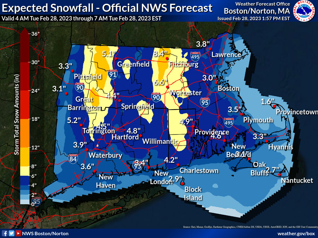
At Providence, snow began Mon 11pm and is expected to end Tue 6pm, with possibly a brief change to rain after Tue 12pm. Snow accumulation 3 – 5 inches expected with temperatures rising above freezing to a Tue afternoon high 37F. Somewhat greater amounts are possible outside the metropolitan area, mainly to the west and south.
Snow accumulation probabilities: at least 0.1in 100%, 1in 98%, 2in 93%, 4in 50%, and 6in near 0%.
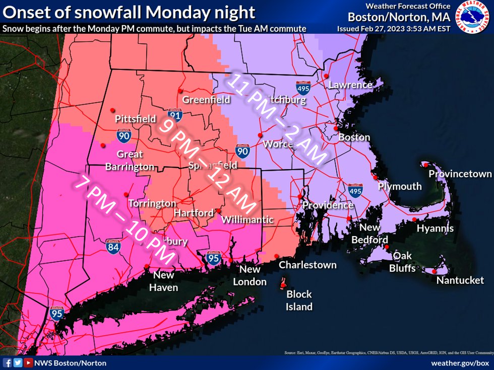
Travel will be difficult with heaviest snow and lowest visibility Mon night into Tue morning, especially affecting the Tue morning commuting period, with snowfall rates less by Tue late morning and early afternoon accompanied by rising temperatures.
A number of municipalities have announced parking bans with some beginning as early as Mon 5pm, including Barrington, Bristol, Burrillville, Central Falls, Coventry, Cranston, Cumberland, East Greenwich, East Providence, Glocester, Hopkinton, Johnston, Lincoln, Middletown, Narragansett, Newport,North Providence, Pawtucket, Portsmouth, Richmond, Scituate, Seekonk (MA), Smithfield, Warren, West Greenwich, West Warwick, Woonsocket. (Warwick has announced a parking ban on social media but not on the centralized statewide system.)
Most public and private schools have announced either complete closure or virtual learning for Tue, including Bristol-Warren, Burrillville, Central Falls, Coventry, Cranston, Cumberland, East Providence, Foster-Glocester, Johnston, Northern RI Collaborative, Pawtucket, Providence, RI School for the Deaf, The Met (Providence and East Bay), Warwick, West Bay Collaborative, West Warwick, Wm M Davies Jr Career-Tech HS, Woonsocket.
More rain is likely Wed night into Thu afternoon, followed by another period of mixed rain and snow Fri morning into Sat morning.