IMPORTANT: This post is out of date and has been superseded; see motifri.com/wx-henri-2021-08-21-1100edt
As of 5am EDT Sat, Aug 21, 2021 in RI:
• A Storm Surge Warning, Tropical Storm Warning, and Hurricane Watch are in effect for Bristol, eastern Kent, Newport, and Washington Counties, including Block Island.
• A Tropical Storm Warning and Hurricane Watch are in effect for western Kent County.
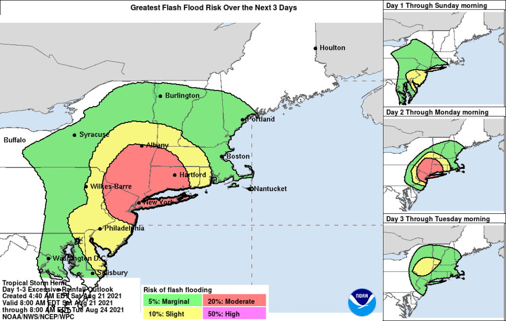
The latest guidance as of 5am EDT Sat, Aug 21, moves the forecast track of Tropical Storm Henri westward to make landfall over Long Island and continue into Connecticut, reducing the effects in Rhode Island, which is now moved into the “slight” 10% risk band for flash flooding due to excessive rainfall.
Rain is likely to begin by Sun, Aug 22, 1am and end by 11pm with peak sustained winds exceeding 20MPH from 11am to 7pm.
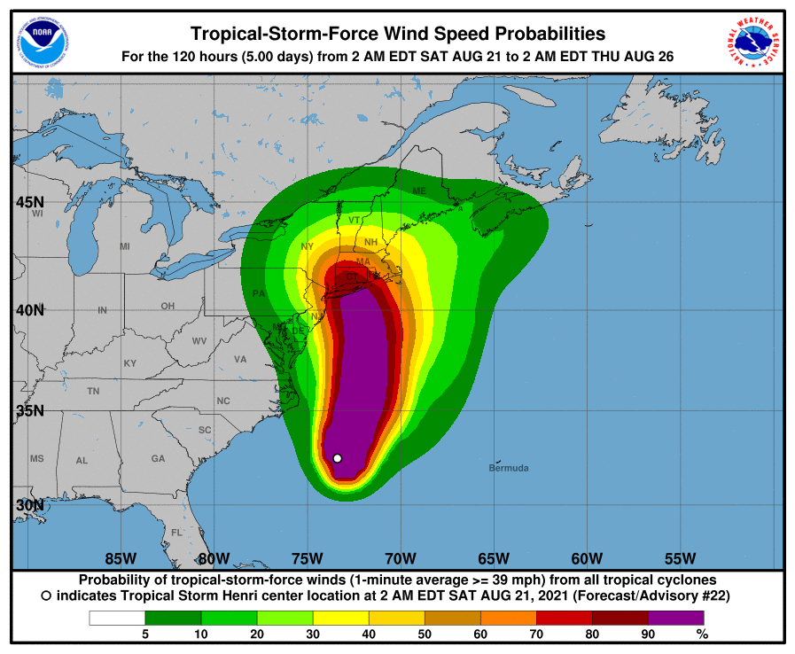
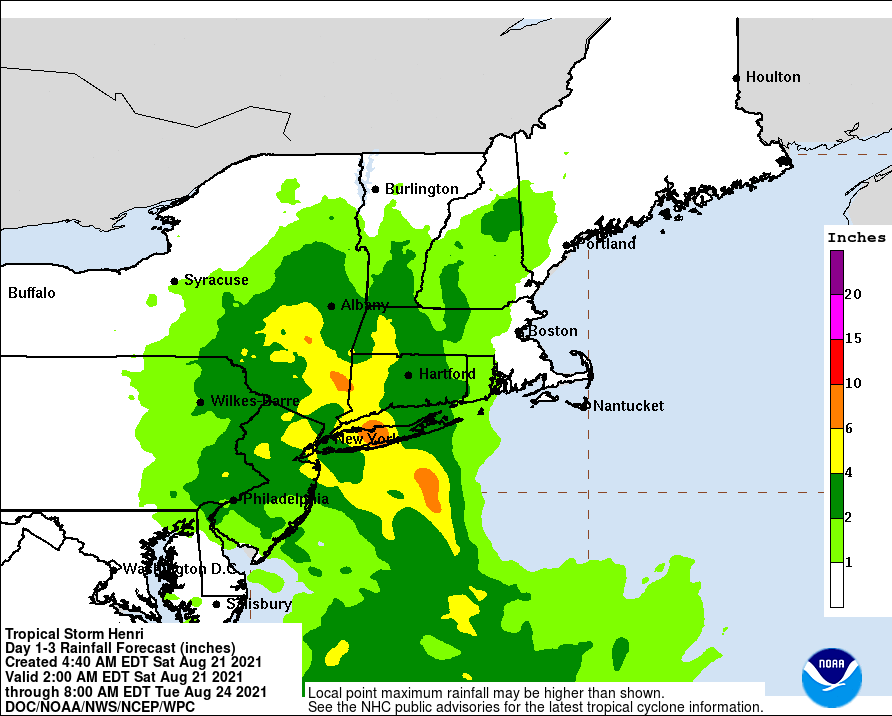
Providence still has a 75% probability of experiencing tropical storm force winds (39MPH) and a 7% probability of hurricane force winds (74MPH), capable of significant damage. RI is forecast to receive 1-2 inches of rain, considerably less than the 6-10 inches in central Long Island and 4-6 inches along the CT coast.
Although RI seems likely to escape the worst effects, TS Henri is expected to strengthen over the next 12-18 hours before making landfall at or near hurricane force. There is little difference in practical effect whether the storm crosses the essentially arbitrary threshold of 74MPH that would classify it officially as a hurricane, and the potential for harm from heavy rain, high winds, and storm surge, as well as life-theatening surf and rip currents, should be taken seriously. All of southern New England can expect what amount to hurricane conditions, regardless of whether they meet the technical criteria.
All tropical weather systems should be regarded as volatile and unpredictable to some extent, so it is a mistake to focus on the exact forecast point of landfall as that may change significantly before it occurs. While this storm is extremely unlikely to “go out to sea” harmlessly, it would be no surprise to see the forecast track move back eastward toward RI and it would be prudent to prepare for that possibility, charging cellular telephones and making sure flashlights and other equipment is powered and ready. Loss of electrical power mains for as long as several days should be part of planning.