- Flood Watch in effect from January 9, 07:00 PM EST until January 10, 01:00 PM EST
- Coastal Flood Watch in effect from January 10, 05:00 AM EST until January 10, 09:00 AM EST
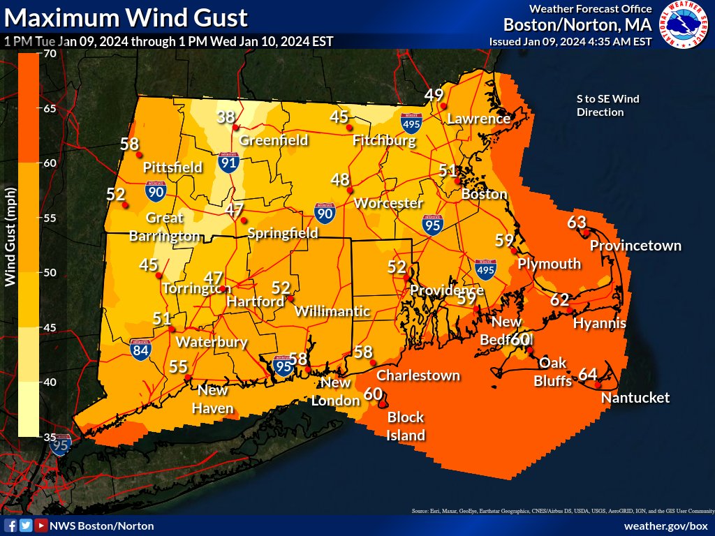
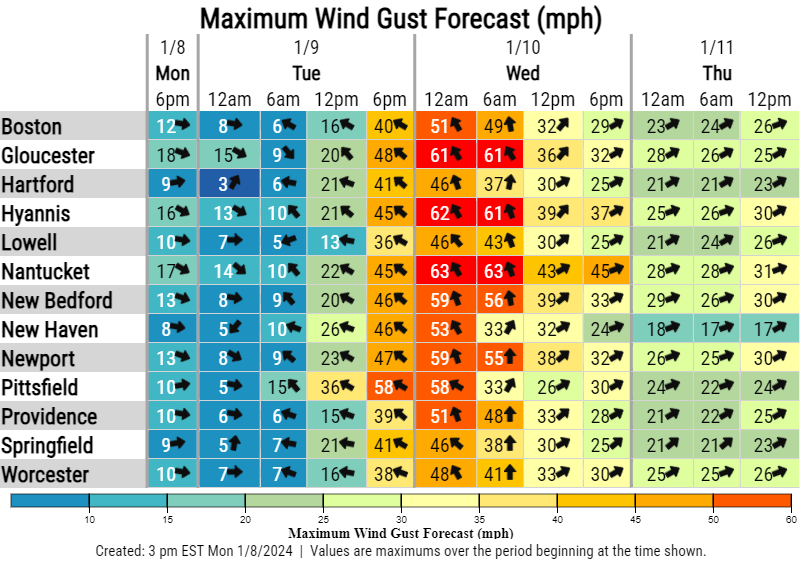
- Wind Advisory in effect from January 9, 05:00 PM EST until January 10, 01:00 PM EST


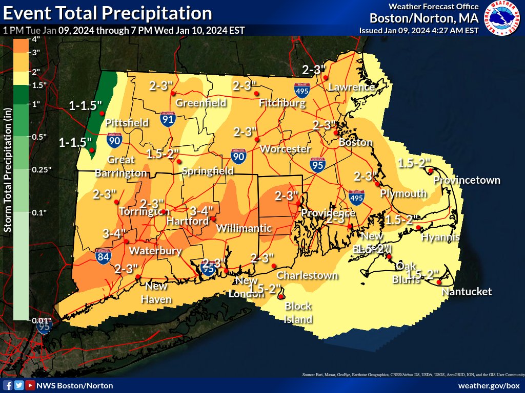
At Providence, a major storm is expected to bring 2 – 3 inches of heavy rain to the metro area starting Tue 3 – 4pm and ending Wed 7 – 8am. High wind gusts exceeding 30MPH are expected Tue 8pm to Wed 2pm, with peak intensity a few hours before and after Wed 4am exceeding 50MPH. On Cape Cod and the islands, gusts exceeding 60MPH are expected.
The main threat is from the strong wind gusts that could take down trees limbs and interrupt electrical power. Inland and coastal flooding are significant but localized risks; rivers and streams could rise above flood stage in the hours after rain stops due to drainage, including from melting snow.
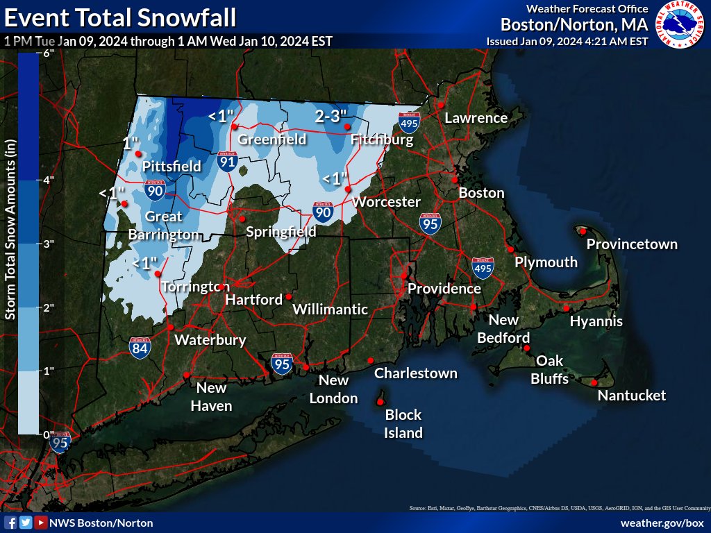
Ambient temperatures in the 40s and 50s throughout the period preclude any possibility of snow in our area (except for the far northwestern corner of RI); snow is likely in central and western MA and parts of northern CT.

