IMPORTANT: This post is out of date and has been superseded; see motifri.com/wx-henri-2021-08-22-1700edt
UPDATE: As of 2pm EDT, Tropical Storm Warnings have been dropped for all of RI except Block Island, and maximum sustained winds have decreased to 50MPH as TS Henri loses strength over land.
As of 11am EDT Sun, Aug 22, 2021 in RI:
• A Storm Surge Warning and Tropical Storm Warning are in effect for eastern Kent, Newport, and Washington Counties including Block Island.
• A Tropical Storm Warning is in effect for Providence and western Kent Counties.
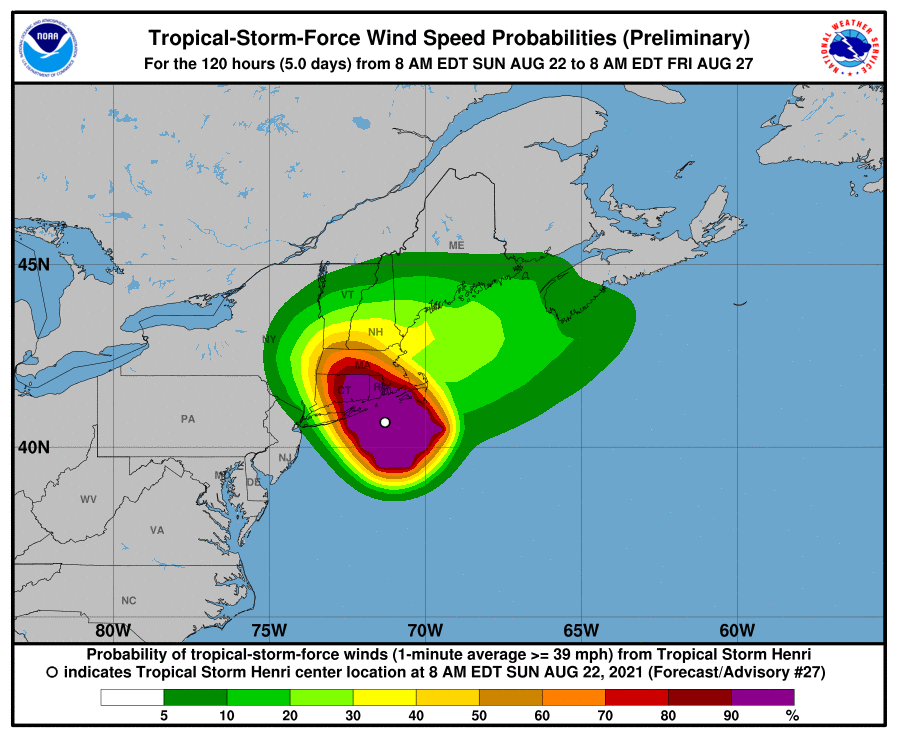
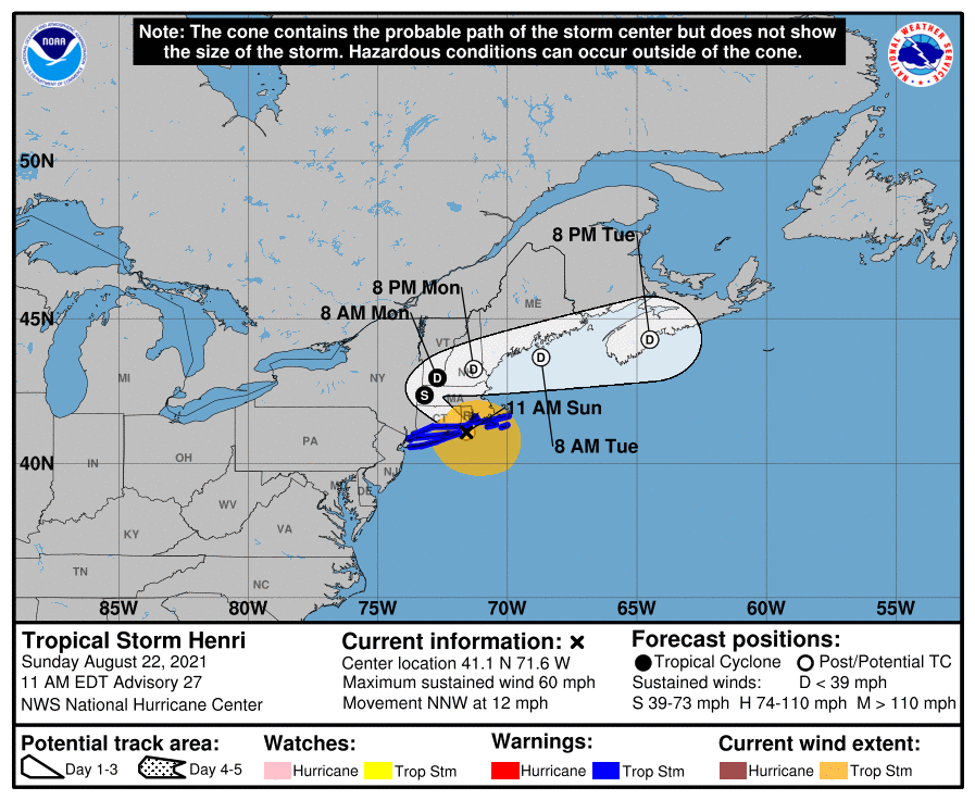
Tropical Storm Henri is centered over Block Island and is on a forecast track northwestward for a direct hit on the RI mainland, as of the guidance at 11am EDT, Sun, Aug 22, with the most likely path making landfall early afternoon in the area of Charlestown. Maximum sustained winds are 70MPH, just short of hurricane force: tropical storm force winds extend 125 miles from the center. Hurricane warnings have been lowered to tropical storm warnings in southern RI due to the slight weakening of the system.
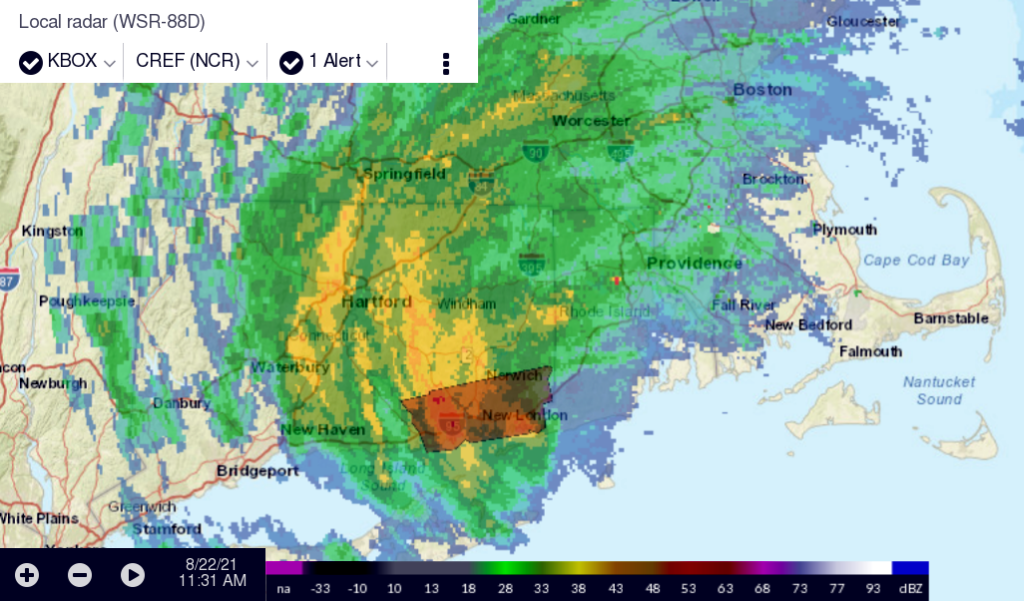
Rain has begun and will likely end by tonight 2am with peak sustained winds exceeding 20MPH until 8pm. The situation is favorable for the formation of tornadoes. A second period of rain is possible Mon 10am to Tue 2am, most likely 5pm to 10pm, but winds less than 15MPH.
Although “probability cone” charts are liable to be misunderstood because they focus on the center of the storm and thereby ignore the field of wind that can extend across hundreds of miles on either side of that track, in this case the direct aim toward RI is striking and illustrative.
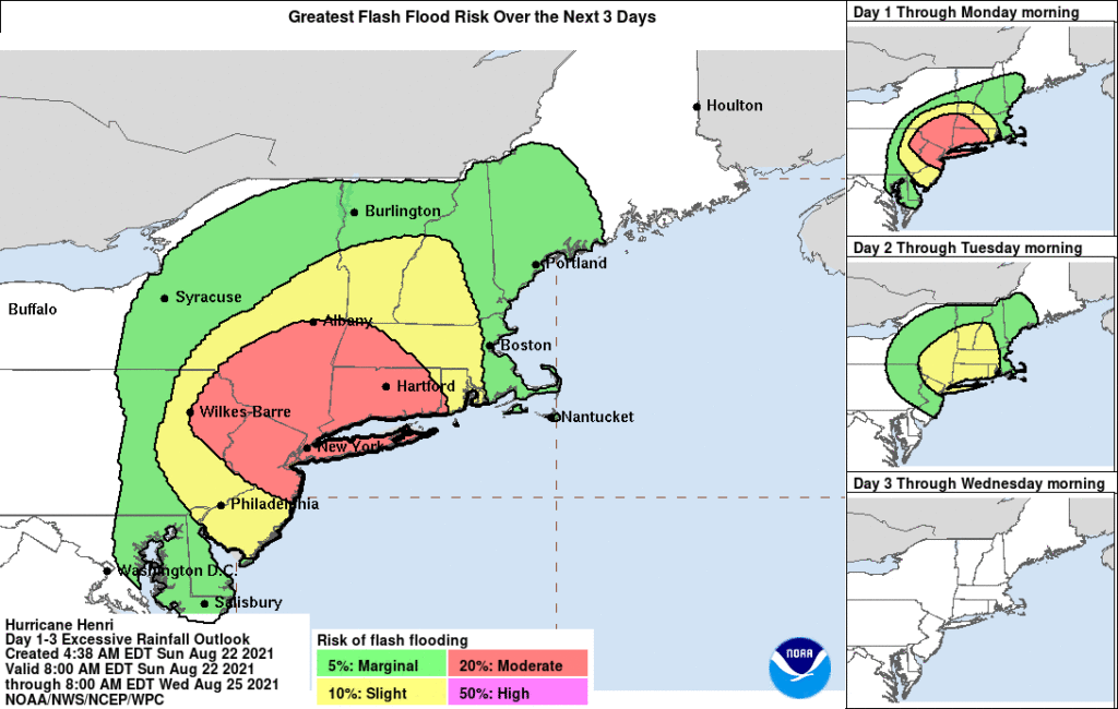
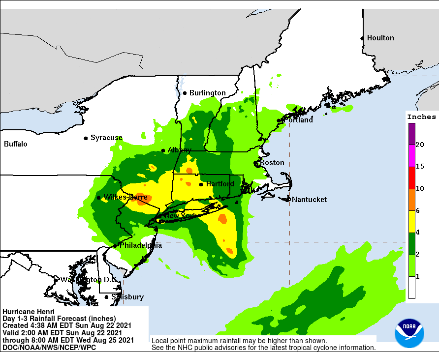
Most of RI except the extreme southwest remains in the “slight” 10% risk band for flash flooding due to excessive rainfall. RI is forecast to receive 2-4 inches of rain, considerably less than the 6-10 inches in central Long Island and 4-6 inches along the CT coast, but this soon could be revised upward. Storm surge of 3-5 feet is possible on the RI coast and within Narragansett Bay.
TS Henri is just short of hurricane strength with maximum sustained winds at 70MPH, but there is little difference in practical effect whether the storm is slightly above or below the arbitrary threshold of 74MPH that would classify it officially as a hurricane, and the potential for harm from heavy rain, high winds, and storm surge, as well as life-theatening surf and rip currents, should be taken seriously. All of southern New England can expect what amount to hurricane conditions, regardless of whether they meet the technical criteria.
All tropical weather systems should be regarded as volatile and unpredictable to some extent, so it is a mistake to focus on the exact forecast point of landfall as that may change significantly before it occurs. While this storm is extremely unlikely to “go out to sea” harmlessly, it would be no surprise to see the forecast track move back and forth closer to and farther away from RI, and it would be prudent to prepare for any possibility, charging cellular telephones and making sure flashlights and other equipment is powered and ready. Loss of electrical power mains for as long as several days should be part of planning.
[The RI Emergency Management Agency uses the CodeRED system to allow the public to sign up for direct community notifications: public.coderedweb.com/CNE/en-US/BF1E5F52D694 ]