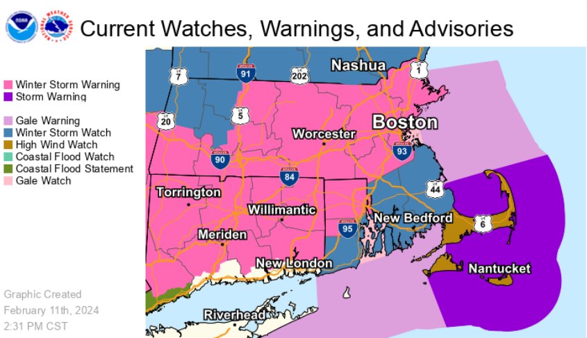
Winter Storm Warning in effect from February 13, 01:00 AM EST until February 14, 01:00 AM EST
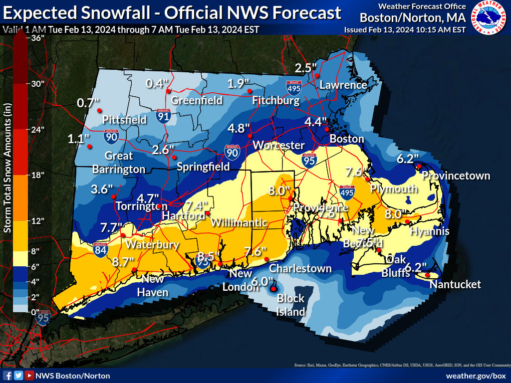
At Providence, precipitation Tue 5am – 3pm is likely to result in significant accumulating snow ranging from 3 inches along the south coast to 10 inches in the western RI and nearby CT, with about 6 inches in the city. The peak of the storm will fall Tue across the morning commute, and the snow during that period is expected to be heavy and wet, contributing some risk of downed power lines and tree limbs causing outages.
This will be a coastal storm developing offshore and passing to the southeast of New England, so its eventual track will define where the rain-snow line turns out to be, with resulting effects on accumulation. Temperatures are expected to be at or slightly above freezing until afternoon, and in much of RI precipitation may begin as or mix with rain before changing to all snow by 9am. Winds are not expected to be a major factor except on the Cape and Islands closer to the offshore storm.
In the metropolitan area, accumulation probabilities: at least 0.1in 98%, 1in 95%, 2in 90%, 4in 72%, 6in 52%, 8in 33%, 12in 10%, 18in 1%.
Considerable uncertainty remains about temperatures and the consequent location of the rain-snow line, so it is important to keep updated on the evolving forecast as the data improve.