[ RI declares state of emergency ]
Blizzard Warning in effect from February 22, 04:00 PM EST until February 24, 07:00 AM EST
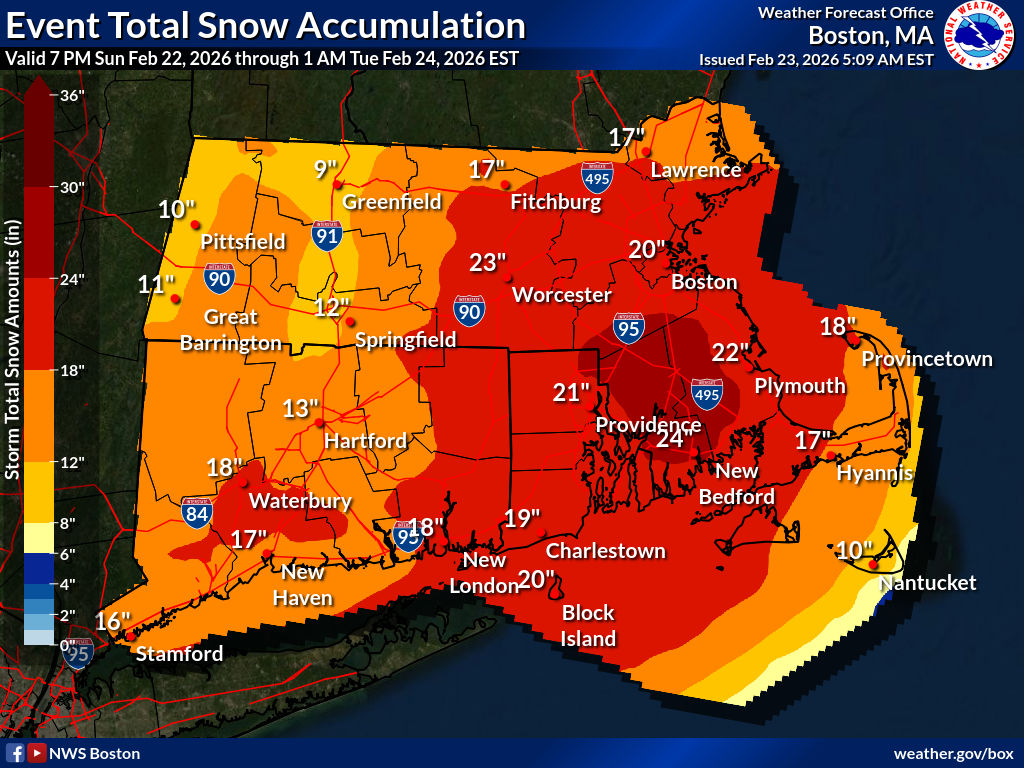

(Source: NWS https://www.weather.gov/source/crh/snowmap.html )

(Source: https://outagemap.rienergy.com/omap )
At Providence, a major classic nor’easter developed offshore and passed to the east of RI, from Sun 9pm to Mon 6pm, bringing heavy snow and blizzard conditions with rates late Sun to early Mon exceeding 2 inches per hour. A Blizzard Warning is posted for Sun 4pm to Tue 7am. Travel will be nearly impossible; expect nearly universal parking bans.
Mon 4am – 4pm, winds reached 30MPH sustained with 55MPH gusts, causing blowing and drifting show and severely reducing visibility. Winds and snowfall rates will decrease after 2pm.
While the median forecast in the metropolitan area is 24 inches, as much as 36 inches is possible. At 1:00pm, the official report at TF Green Airport was 32.8 inches, breaking the all-time record of 28.6 inches set by the Blizzard of 1978 on Feb 6 – 7, 1978.
RI Energy reports over 40,000 customers without electricity.

