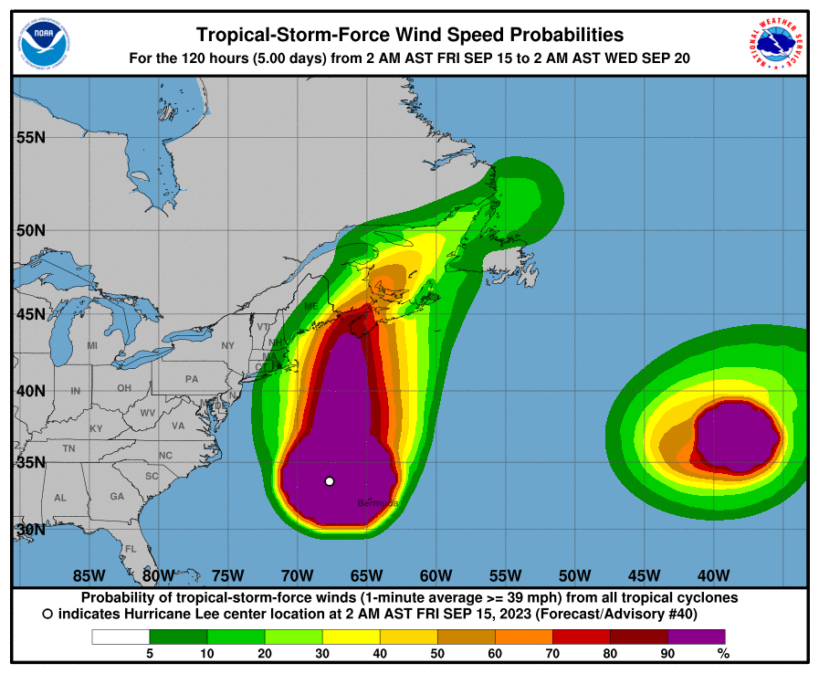
As of Fri morning, Providence faces significant threat with 18% chance of tropical storm force winds and less than 1% chance of hurricane force winds during the forecast period, with peak wind gusts to 35MPH Sat 2am – 5pm but only 15 – 20% chance of rain Sat 9am – 3pm, although there is at least 10% chance of rain in the four to six hours preceding and following.
Current forecast models predict the hurricane to remain well offshore from the East Coast, possibly making landfall in the Canadian Maritimes although likely by then greatly weakened by traversal over cold ocean water.
The hurricane is already powerful enough and close enough to cause rip currents and dangerous surf as far as Narragansett Bay.
In the US:
- A Hurricane Watch is in effect for Petit Manan Point, Maine to the U.S./Canada border.
- A Tropical Storm Warning is in effect for Westport Massachusetts northward to the U.S./Canada border; Martha’s Vineyard; Nantucket.
As of Fri 8:00am EDT (1200 UTC), the center of Hurricane Lee was located near latitude 35.1 North, longitude 67.0 West. Lee is moving toward the north near 16 mph (26 km/h), and a northward motion at a faster forward speed is expected through Saturday. On the forecast track, the center of Lee will continue to move farther away from Bermuda this morning and approach the coast of New England and Atlantic Canada today and Saturday. Lee is then expected to turn toward the north-northeast and northeast and move across Atlantic Canada Saturday night and Sunday. Maximum sustained winds are near 85 mph (140 km/h) with higher gusts. Little change in strength is expected through tonight. Lee is forecast to become post-tropical and begin weakening by Saturday, but it is still expected to be a large and dangerous storm when it reaches eastern New England and Atlantic Canada. Hurricane-force winds extend outward up to 105 miles (165 km) from the center and tropical-storm-force winds extend outward up to 320 miles (520 km). The minimum central pressure based on data from the NOAA Hurricane Hunter aircraft is 962 mb (28.41 inches).