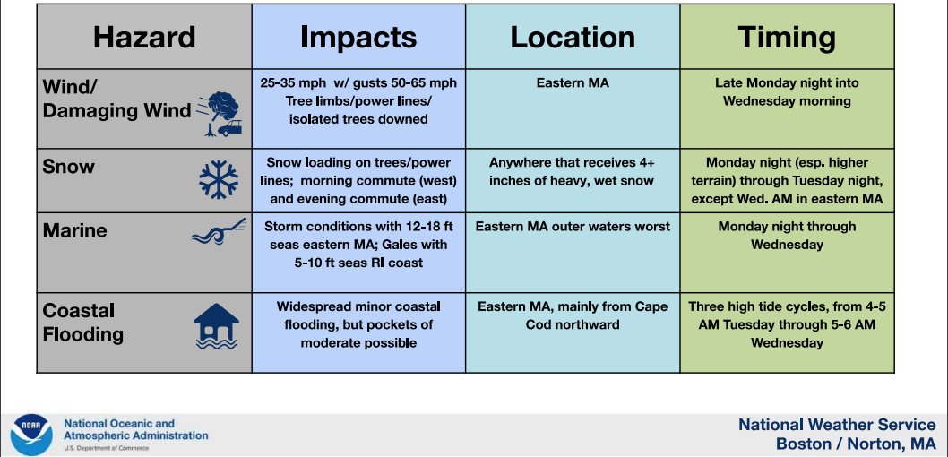
A Winter Storm Warning has been issued for Mon 8pm – Wed 8am (including Providence County).
At Providence, steady rain is expected to change to snow Tue late afternoon before ending Wed 2am. Temperatures well above freezing should prevent accumulation before Tue afternoon, with a low of only 33F overnight Tue 8pm – Wed 8am.
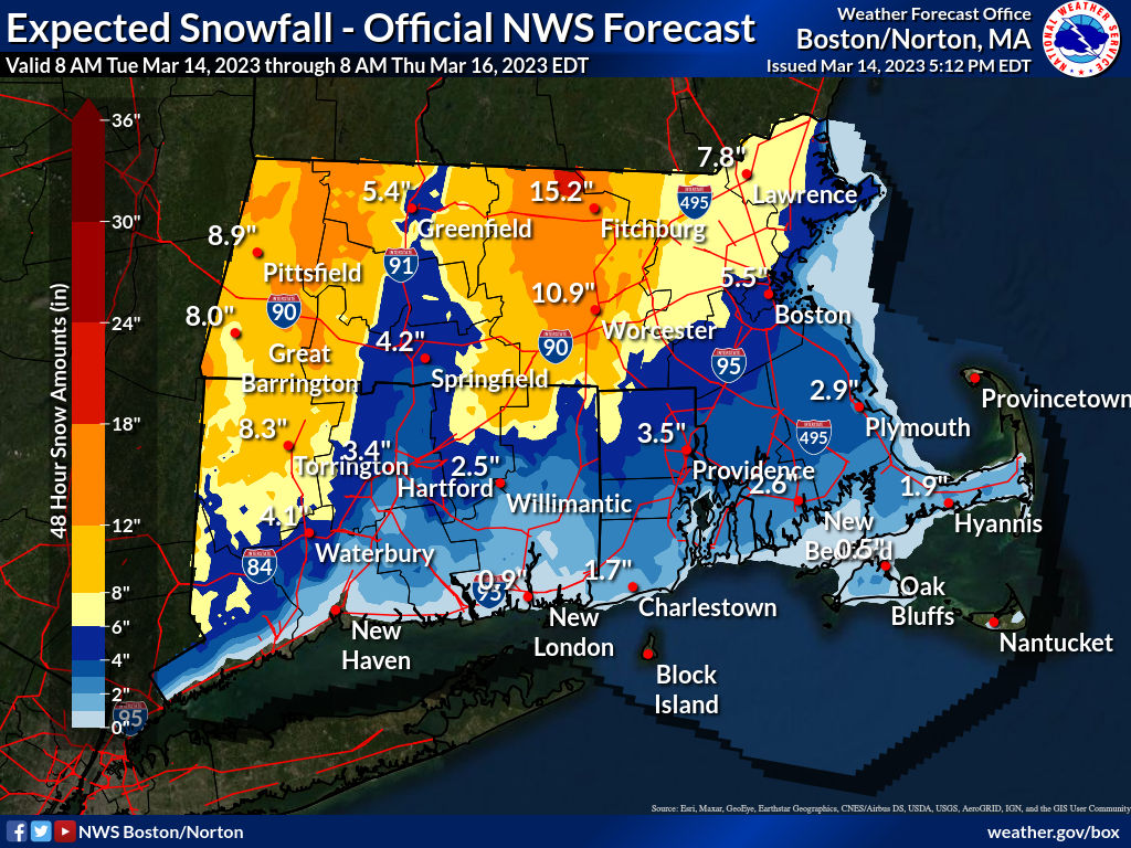
Snow accumulation probabilities: at least 0.1in 81%, 1in 74%, 2in 65%, 4in 46%, 6in 30%, 8in 18%, 12in 4%, and 18in near 0%.
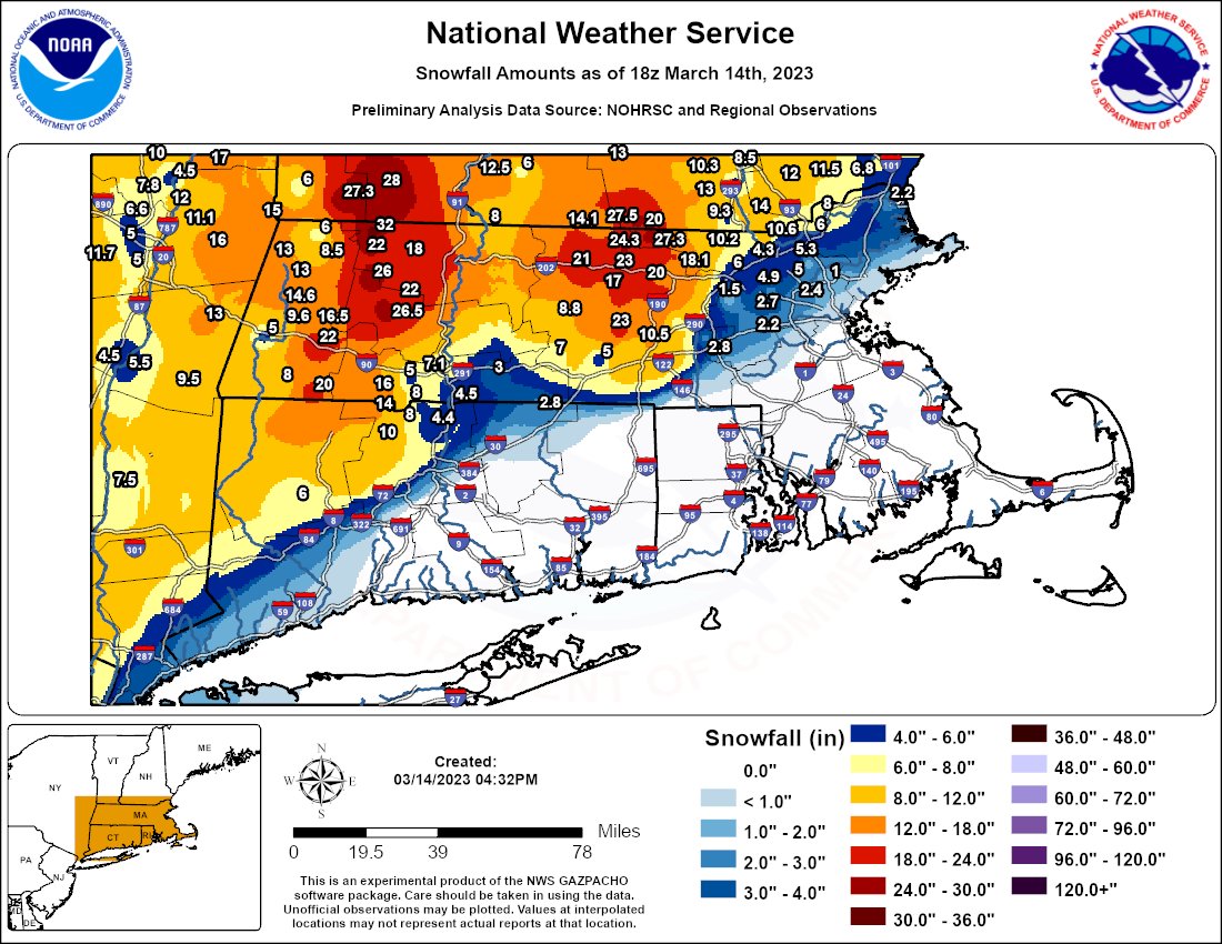
The forecast is highly uncertain and complicated, involving development of storms off the Long Island coast drawing a supply of cold air from the north, and at this time it is hard to predict the intensity of the effects as well as where and when rain changes to snow: anything from all rain to 8in snow is within the realm of realistic possibility for the metropolitan area. To the north and west much greater accumulation is likely, with as much as 2ft in northern and western MA.
Winds exceeding 25MPH sustained with 50MPH gusts Tue and Wed could damage trees and power lines, especially because the snow is expected to be heavy and wet, stressing roofs and buildings.