Winter Storm Warning in effect from Sat, Jan 6, 4pm EST until Mon, Jan 8, 1am EST for northwestern Providence County as well as nearby CT and MA.
Winter Weather Advisory in effect from Sat, Jan 6, 4pm EST until Mon, Jan 8, 1am EST for southeastern Providence County and Kent County.
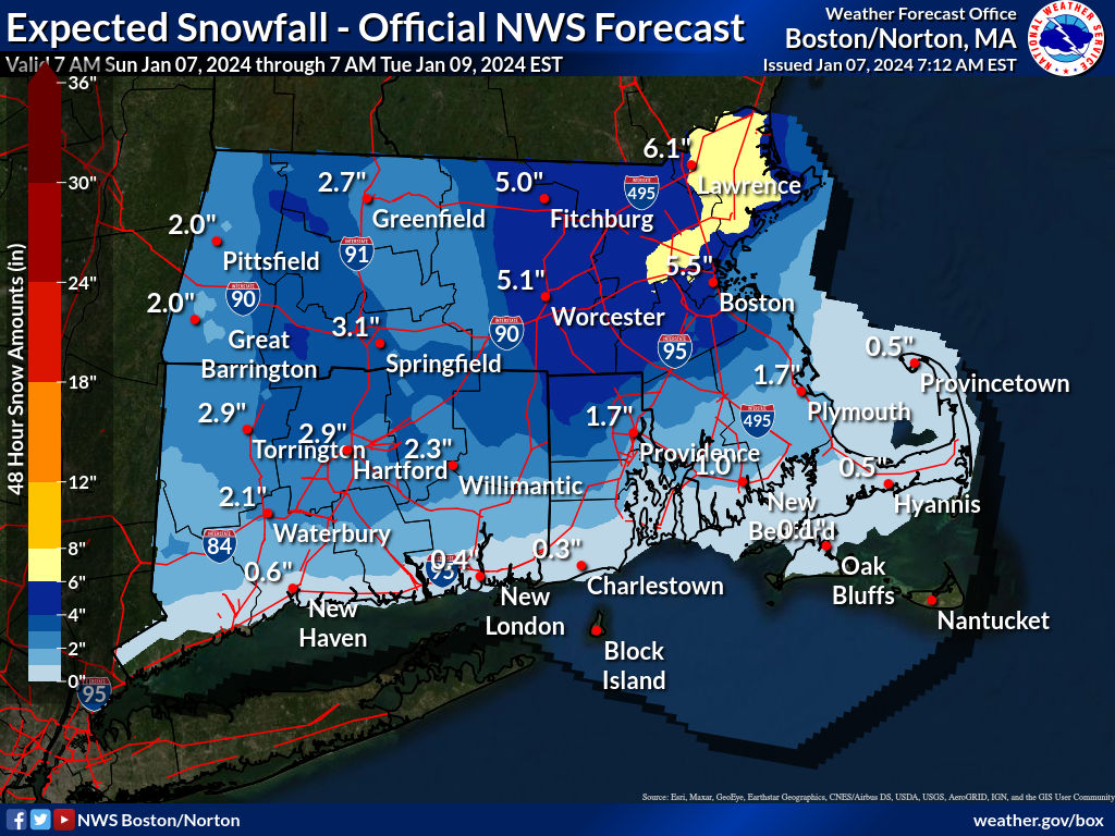
At Providence, the first accumulating snowfall of the 2023 – 2024 winter season occurred, but the uncertain storm track brought the position of a line between rain and snow farther north than predicted, reducing accumulation.
In metropolitan Providence, snow began Sat 8pm and mixed with rain overnight, but is expected to become all snow Sun 11am before tapering off 6pm. Temperatures a few degrees above freezing throughout the period until Sun 11am may limit accumulation. To the northwest, Burrillville will stay several degrees below freezing, increasing accumulation.
Small differences of only a few miles will interact with the storm track to produce radically different results, with the current forecast model leading to an expectation for 4 – 8 inches of snow to the north and west of Providence, including the northwest parts of the state; for 1 – 3 inches in the metropolitan area; and for all rain to the south and east, especially close to the coast.
Snow accumulation probabilities in the metropolitan area: at least 0.1in 84%, 1in 71%, 2in 54%, 4in 23%, 6in 6%, 8in 1%, 12in near 0%.